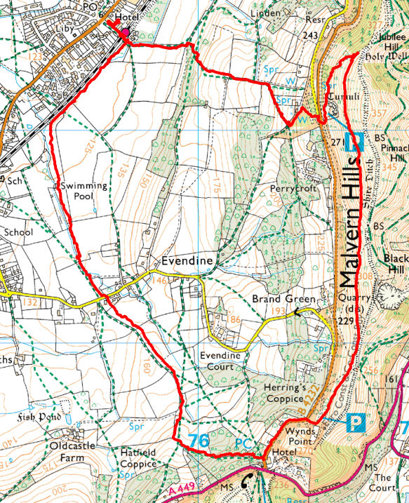
Colwall Stone Evendine 4.8 miles 1h 57 m
719 ft vertical
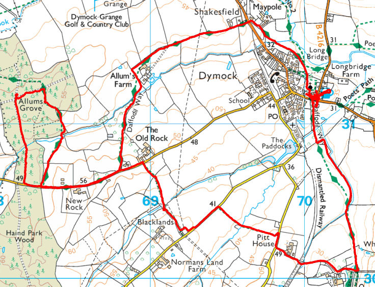
Daffodile way from Dymock 5.8 miles 2h 30 m 690 ft vertical
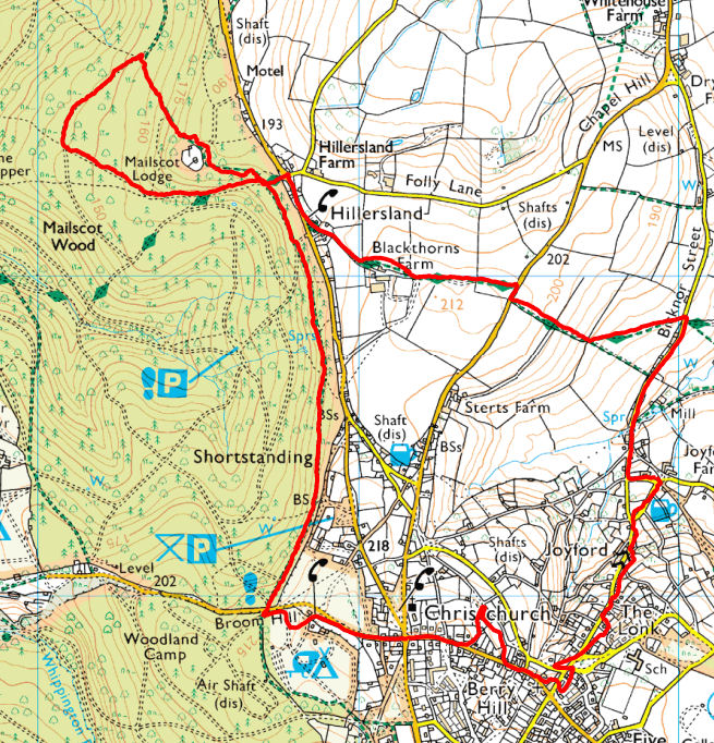
Christchurch, Nine Wells 6.5 miles 2h 1 m 930 ft vertical
Corse, Eldersfield 5.3 miles 2h 13 m 108 ft vertical
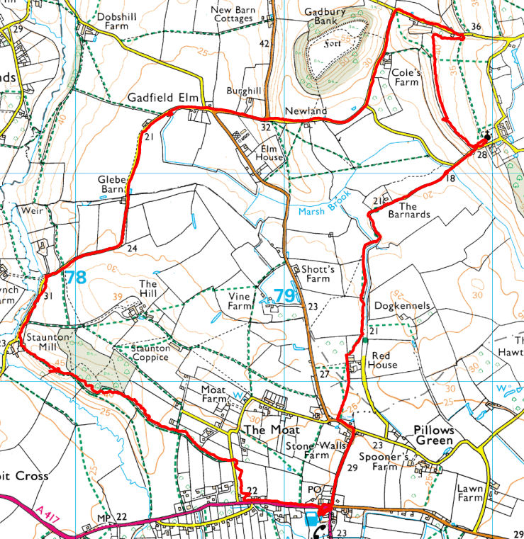
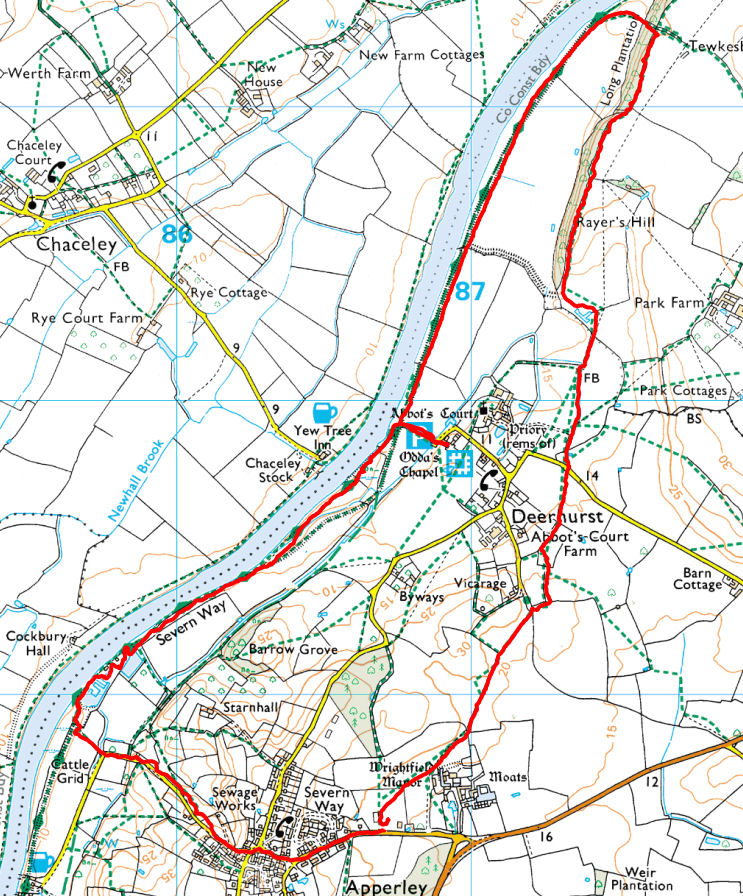
Apperley, Deerhurst 4.7 miles 2h 21 m 128 ft vertical
From Farmers Arms Apperley
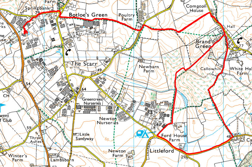
Botloes Green 6.0 miles 2h 22 m 390 ft vertical
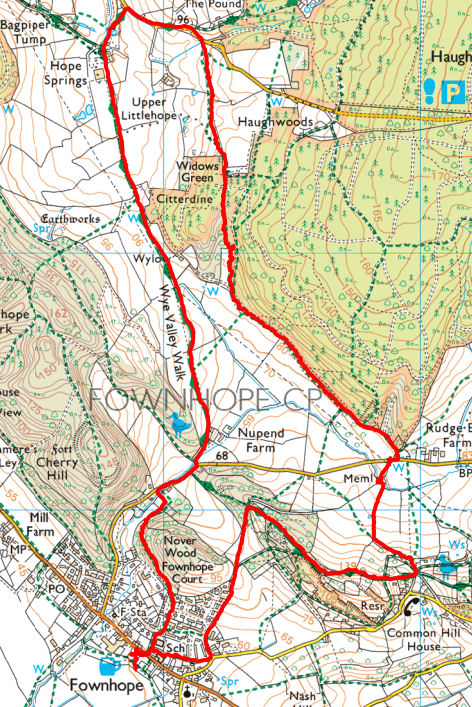
Fownhope, Bagpipers Tump 5.5 miles 2h 12 m
515 ft vertical
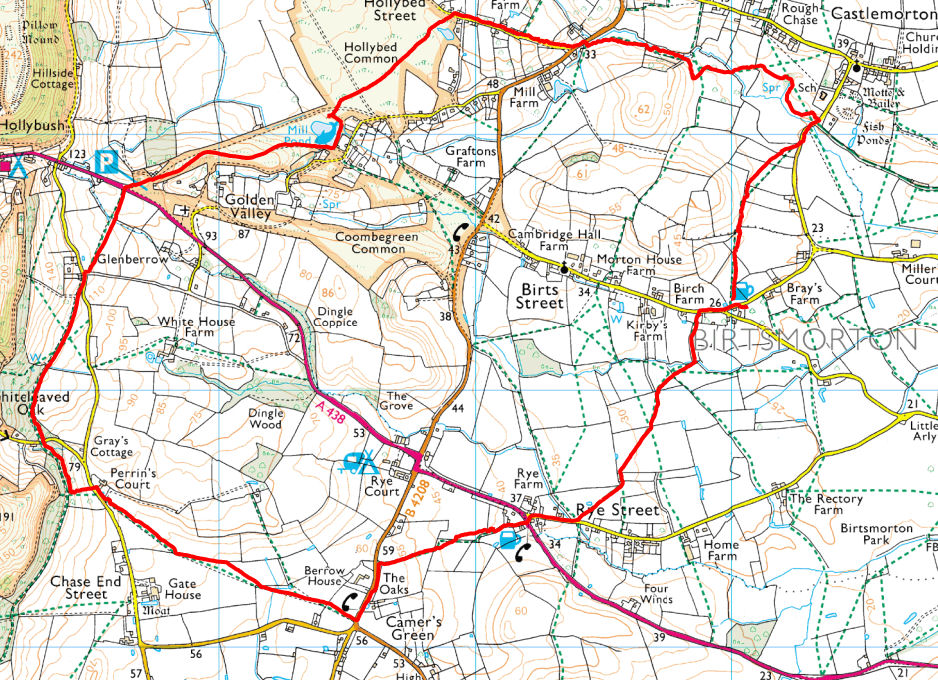
Birts Street, Castlemoreton and Hollybush 6.2 miles 2h 25 m 380 ft vertical
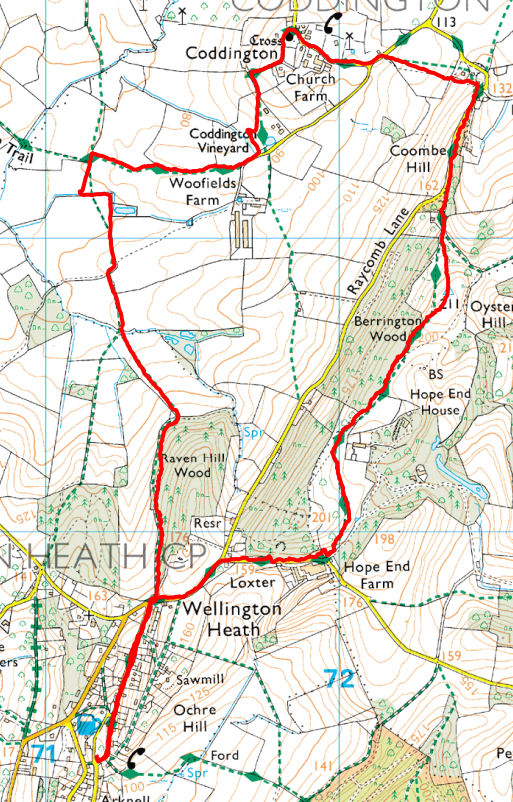
Wellington Heath, Coddington 5.9 miles 2h 1 m 1102 ft vertical
525 ft vertical
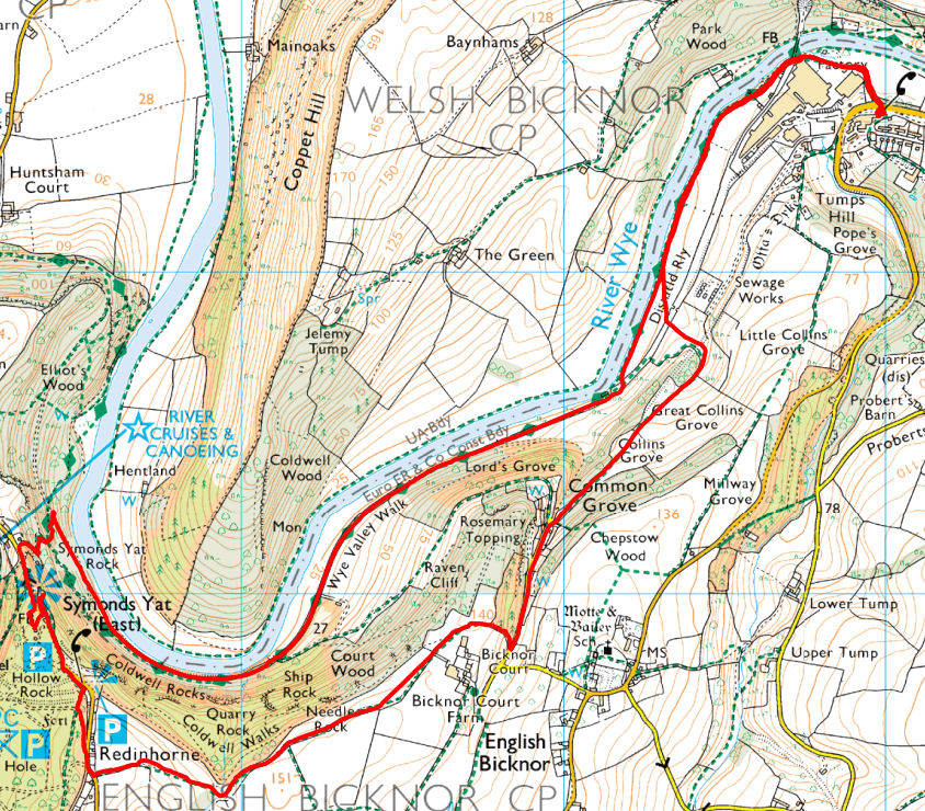
Lydbrook - Symonds Yat 6.1 miles 2h 16 m 525 ft vertical
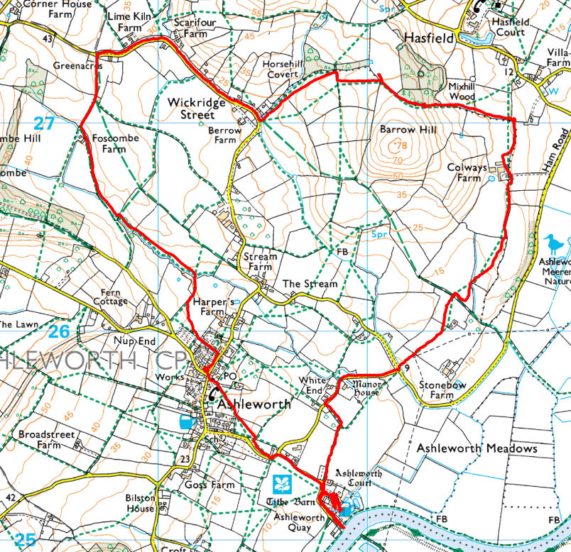
Ashleworth, Wickridge St, Foscombe 5.7 miles 2h 17 m 302 ft vertical
From: Ashleworth Hub
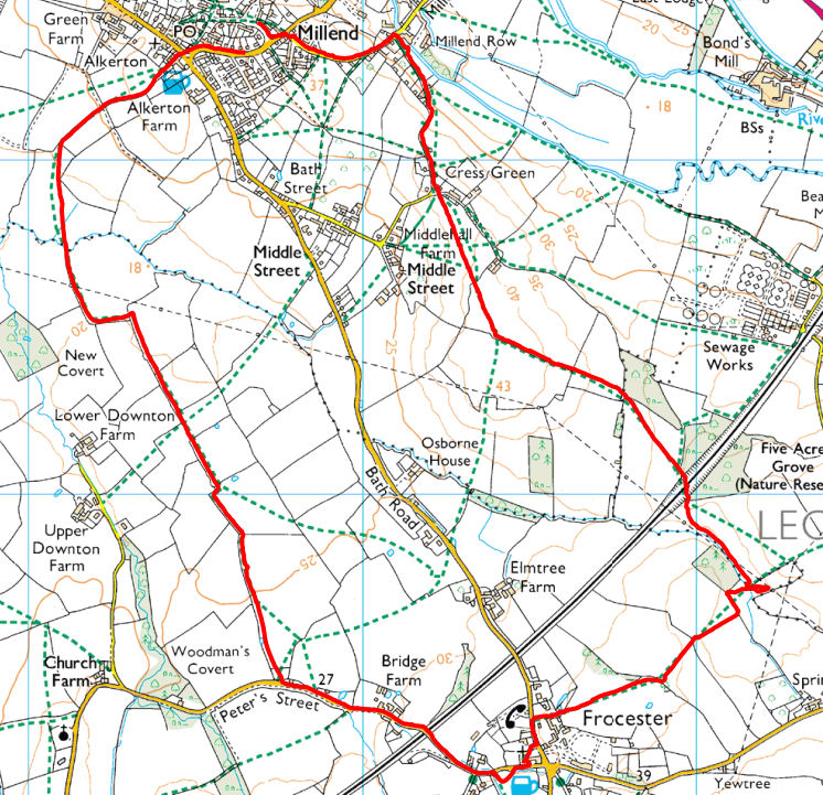
Eastington, Westend via Frocester 6.4 miles 2h 6 m 172 ft vertical
From: Old Badger, Eastington
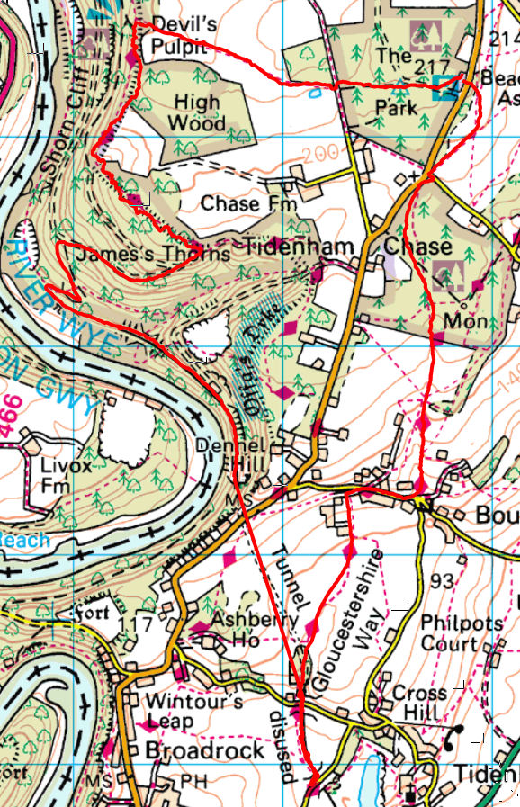
Tidenham, Devils Pulpit 8.2 miles 3h 4m 1112 ft vertical
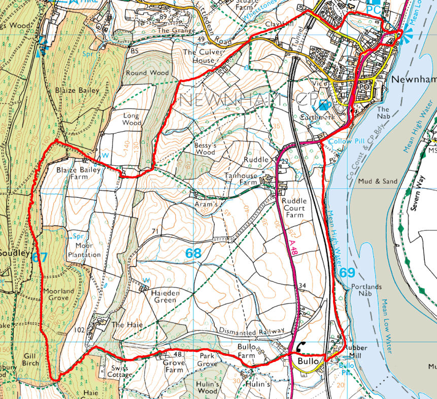
Newnham, Blaze Bailey, Bullo 6.5 miles 2h 38m 870 ft vertical
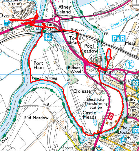
Over, Castlemeads 4.7 miles 1h 40m 111 ft vertical
From The Warfe Restaurant, Over
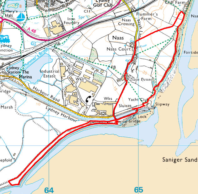
Around Lydney Harbour 4.2 miles 1h 55m 105 ft vertical
From: Lydney Harbour
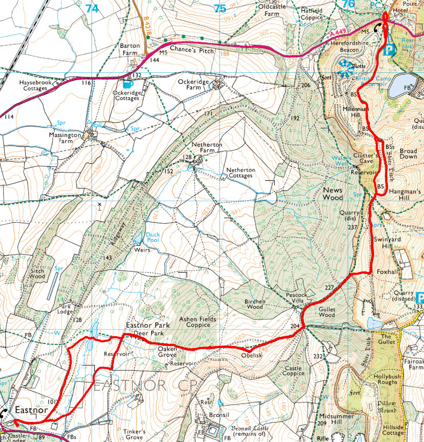
Eastnor - British Camp & return 7.7 miles 3h 10m 1211 ft vertical
From: The Woodshed, Eastnor
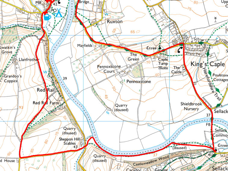
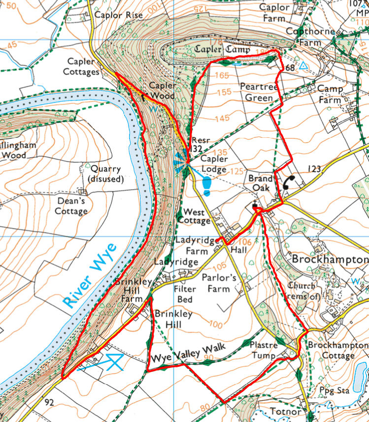
Hoarwithy, Sellack and Kings Caple 5.5 miles 2h 5m 361 ft vertical
From: New Harp, Hoarwithy
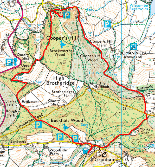
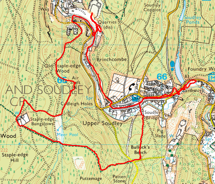
Dean Heritage Centre - Soudley, Staple Edge, Ruspidge Quarry
6.2 miles, 2 hr 15min, 780 ft vertical
Lunch: Dean Hritage Centre
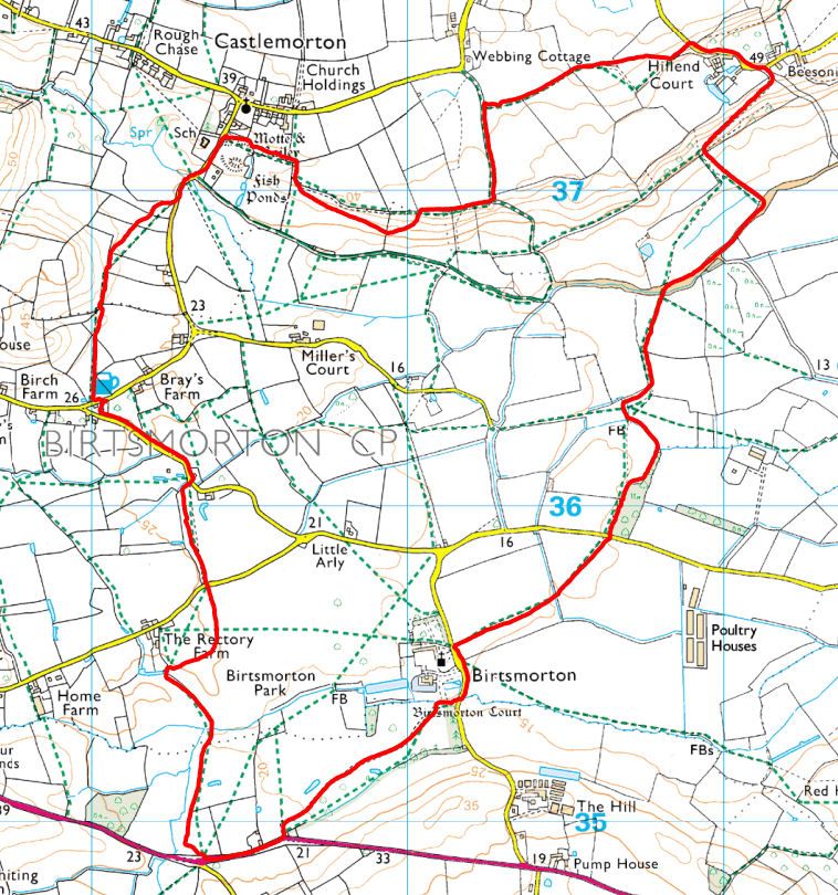
Birtsmorton Castlemorton loop 5.75 miles 2h 8m 217 ft vertical
Lunch: Farmers Arms, Birtsmorton
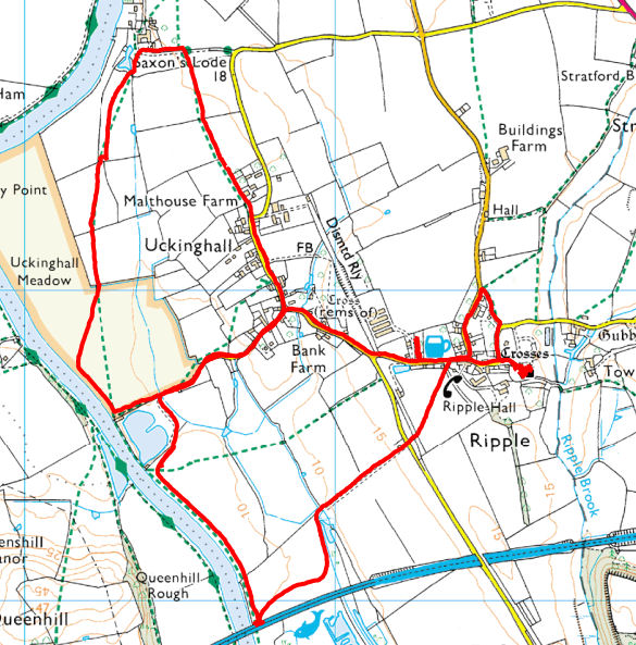
Ribble - Uckinghall Nature Reserve
5.1 miles, 2 hr 5min, 85 ft vertical
Lunch: Old Railway Inn
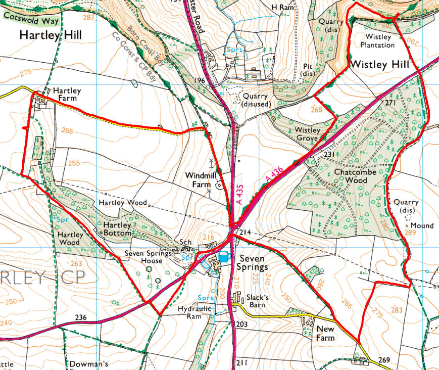
Seven Springs Devil's Chimney
4.6 miles, 1 hr 45min, 354 ft vertical
Lunch Star College Bistro

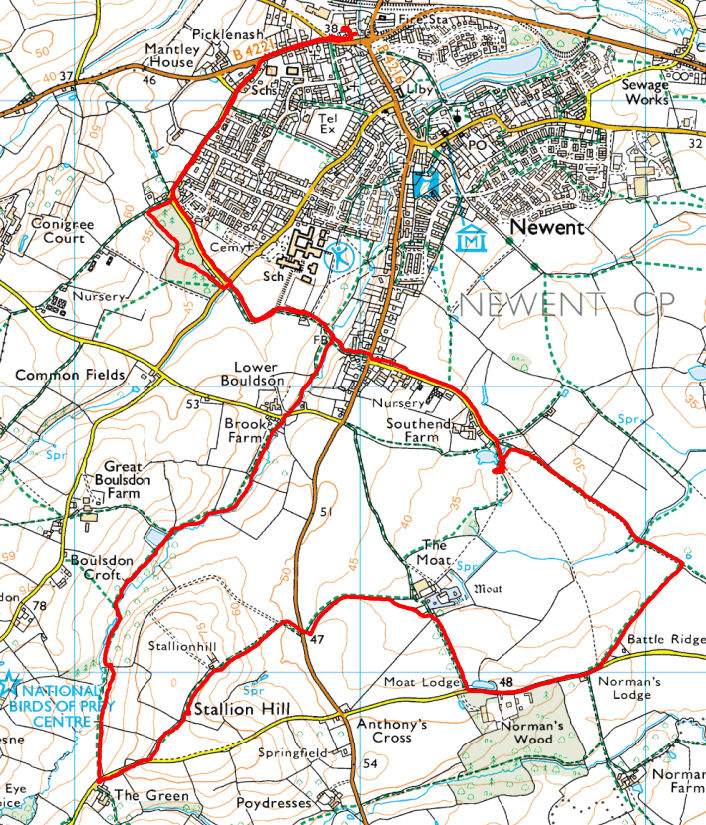
Newent, St Anthony's Cross
6.7 miles, 2 hr 29min, 325 ft vertical
Lunch: Kings Arms
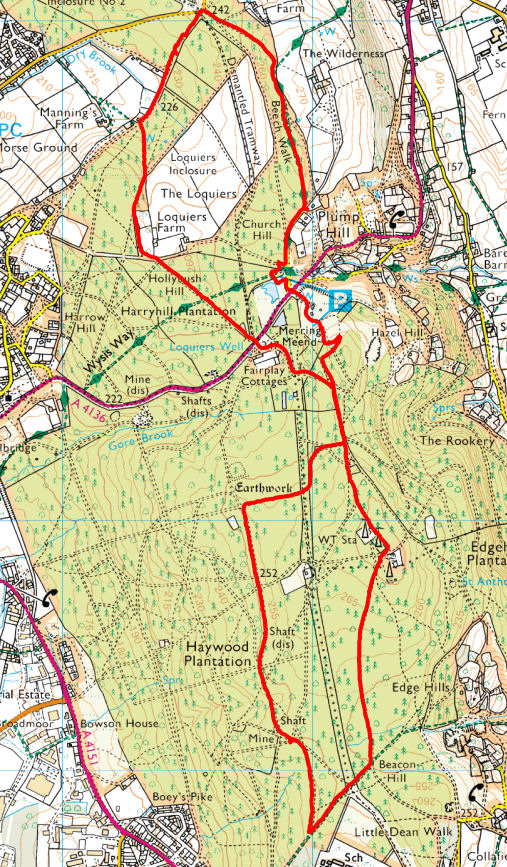
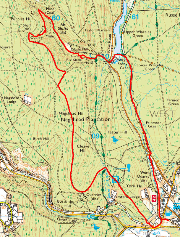
Plump Hill Pond Loop
5.3 miles, 2 hr 18min, 257 ft vertical
Lunch: Heart of Oak, Drybrook
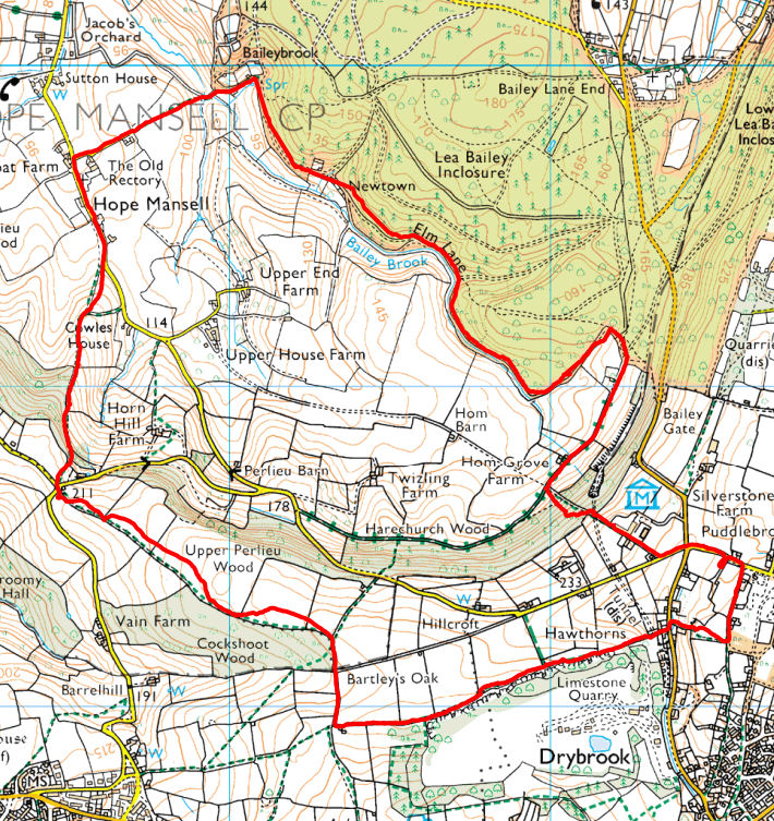
Puddlebrook Hope Mansell
5.1 miles, 2 hr 16min, 666 ft vertical
Lunch: Woodlands Cafe, Puddlebrook
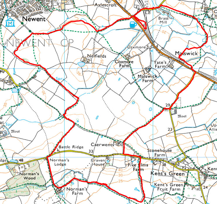
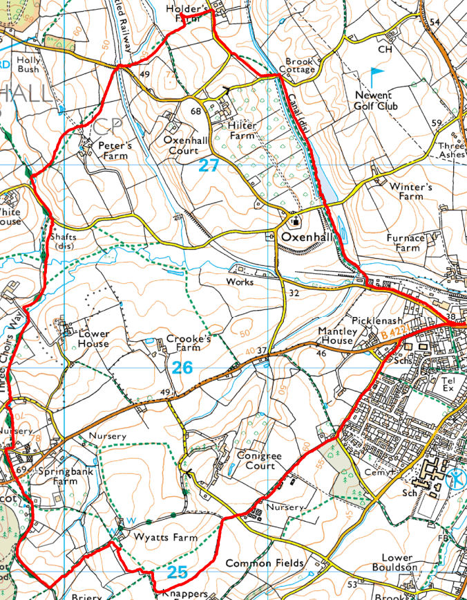
Newent, Oxenhall
5.9 miles, 2 hr 11min, 325 ft vertical
Lunch: Kings Arms
5.5 miles, 2 hr 12min, 358 ft vertical
Lunch: Star College Bistro
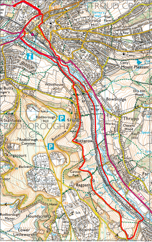
Stroud hike along River Frome Butterow, Bagpath Stroudwater canal.
6.2 miles, 2 hr 8min, 224 ft vertical
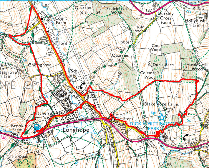
5.2 miles, 2 hr 3min, 750 ft vertical
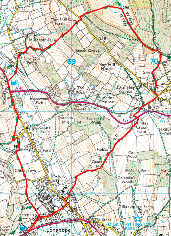
Lunch: Yew Tree, Longhope
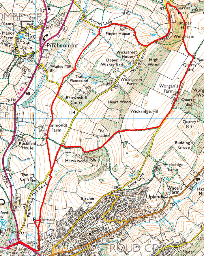
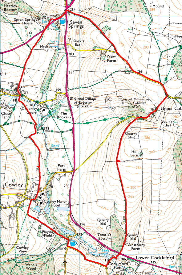
Seven Springs, Laverok
6.5 miles, 2 hr 32min, 476 ft vertical
Lunch: Star College Bistro
6.5 miles, 2 hr 32min, 476 ft vertical
Lunch: Star College Bistro
5.7 miles, 2 hr 20min, 499 ft vertical
Lunch: Fountain Inn, Parkend
5.1 miles, 2 hr 1min, 430 ft vertical
Lunch: Inn on the Wye, Kerne Bridge
4.4 miles, 1 hr 49min, 128 ft vertical
Lunch: Yew Tree, Longhope

5.1 miles, 1 hr 56min, 617 ft vertical
Lunch: New Harp Inn, Hoarwithy
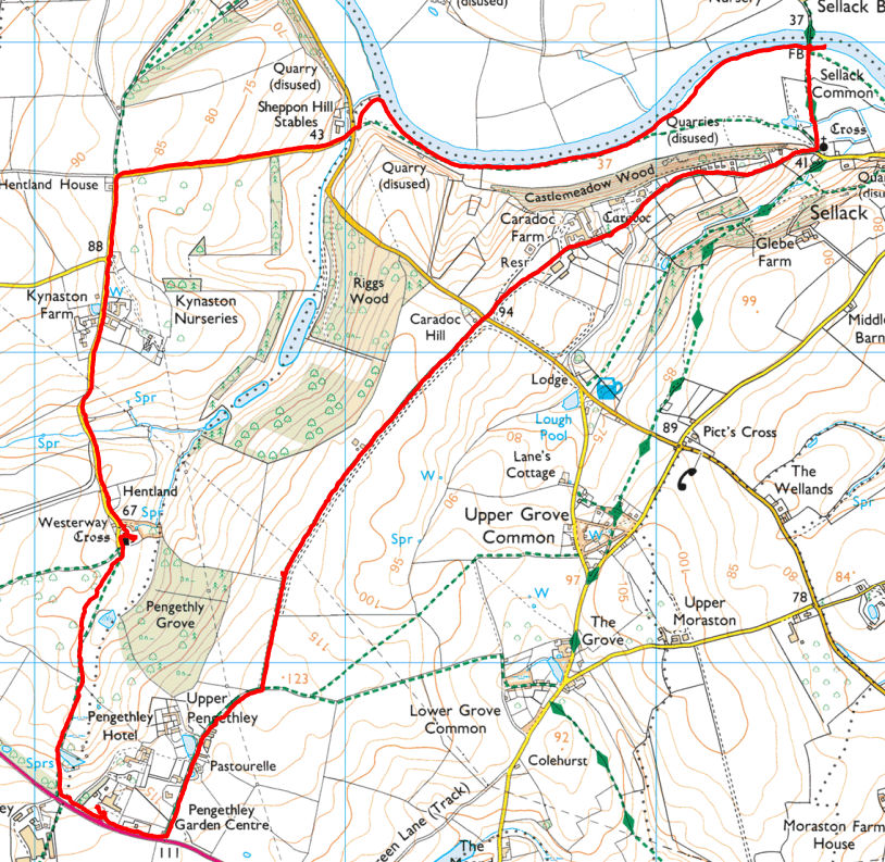
5.8 miles, 2 hr 8min, 289 ft vertical
Lunch: Pengethley Garden Centre
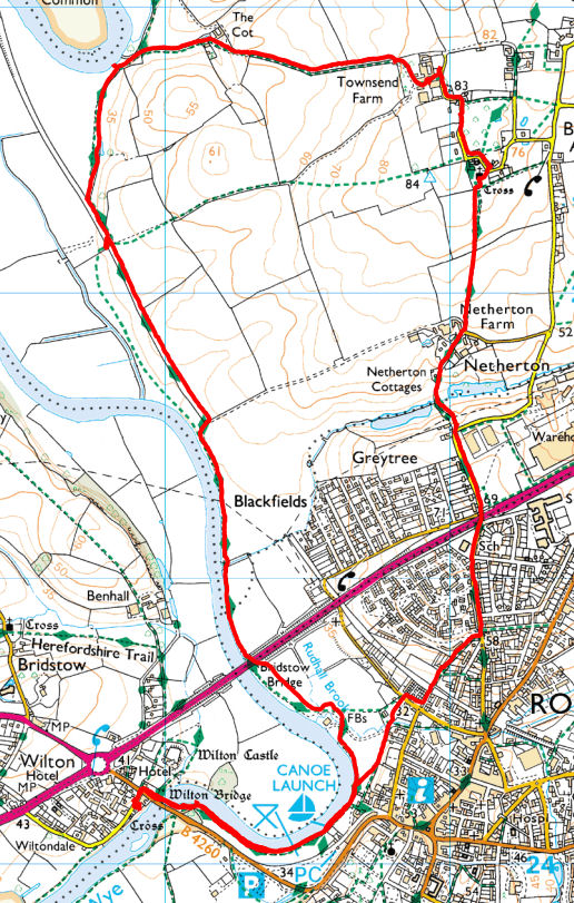
6.2 miles, 2 hr 14min, 249 ft vertical
Lunch: White Lion, Wilton